 sales@uslandgrid.com
 Phone : 877-870-8872

Evolution of the Land Grid
Land grid data is basically the information that maps out land into a grid or network, based on set coordinates or natural landmarks. These grids help to identify, manage, and keep track of different land assets.
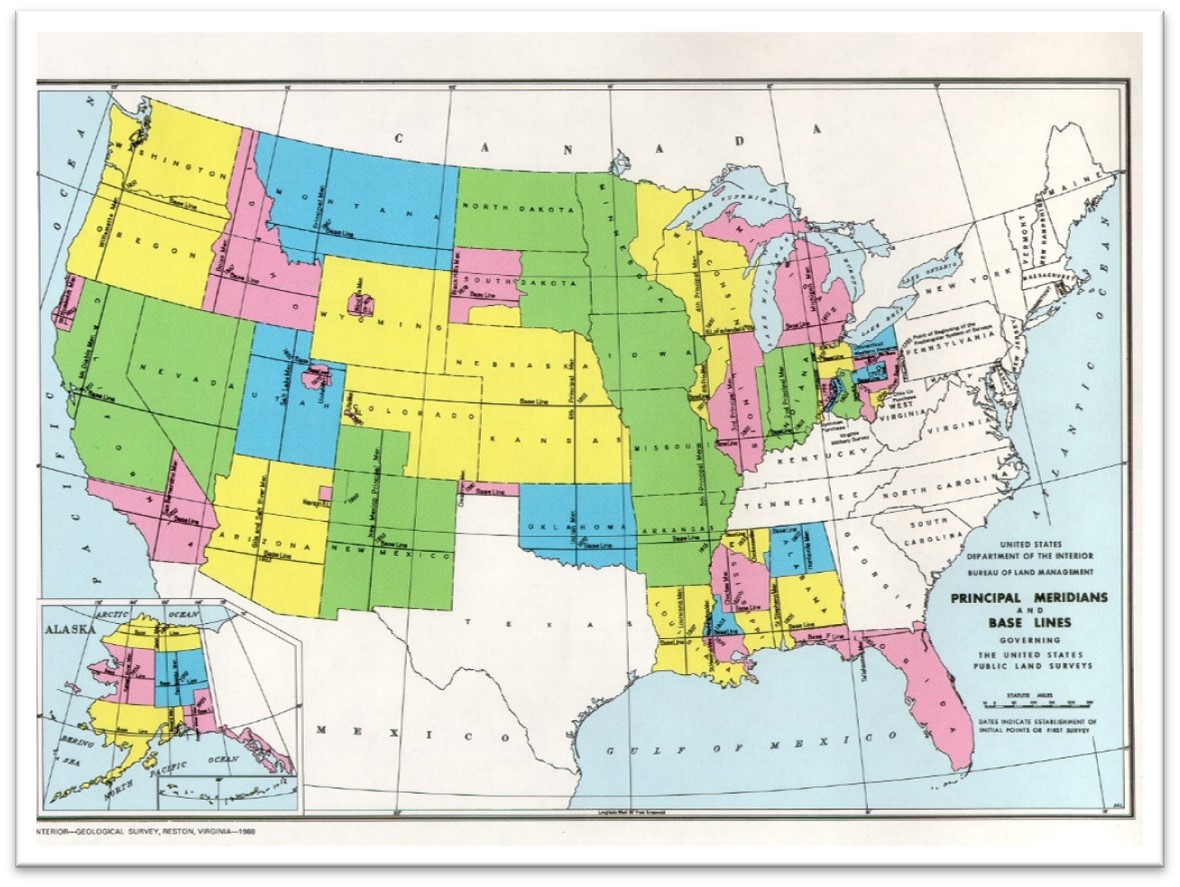
Thomas Jefferson is synonymous with this land grid. As the father behind westward expansion and distribution of the land that came with it, he believed that dividing the land into uniform parcels through the Public Land Survey System (PLSS) would encourage land ownership and participation in the new territories.
Public Land Survey System (1785): Introduced a standardized grid system in the United States.
Spanish Land System (1777): The Spanish government began issuing detailed instructions for land distribution, including requirements for settlement and development.
Mexican Land System (1821): Mexico gained independence from Spain, and Texas became part of the newly independent Mexican nation.
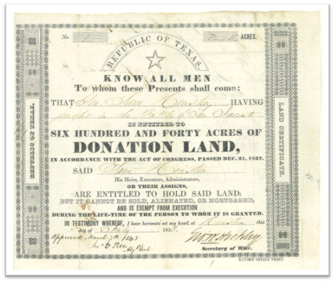
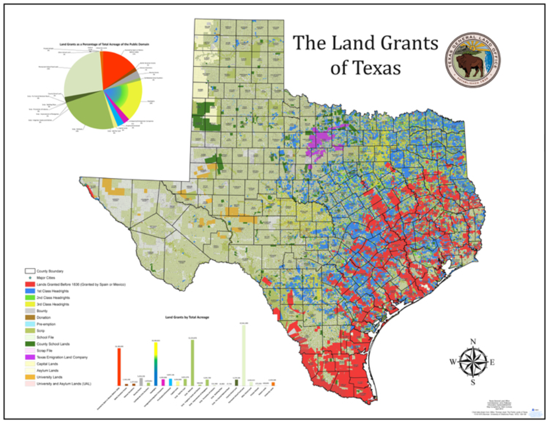
Texas General Land Office established (1836): The creation of the GLO was a crucial following its independence from Mexico and eventual annexation to the United States.
Mexican-American War (1846): Mexico cedes its northern territories to the US (CA, NV, UT, AZ, part of CO, WY, NM, and TX)
Aerial Photography (1900s): Revolutionized mapping with accurate and detailed imagery.
Satellite Remote Sensing (Late 20th Century): Provided real-time monitoring and mapping capabilities.
GIS Development (1960s-1970s): Enabled the integration and analysis of spatial data.
Digital Transformation (Early 21st Century): Transitioned from paper maps to digital formats, enhancing accuracy and accessibility.
Structure of Land Grids
Land grids are typically structured in a hierarchical manner, ranging from broad divisions to more specific parcels. The most common structure involves several key components:
Baseline and Meridian: The starting points for a land grid system, usually determined by a principal meridian (north-south line) and a baseline (east-west line).
- Townships: Large squares of land, typically 6 miles by 6 miles, created by the intersection of range lines (north-south) and township lines (east-west).
- Sections: Each township is divided into 36 sections, each 1 mile by 1 mile, containing 640 acres.
- Quarter Sections and Further Divisions: Sections can be further divided into quarter sections (160 acres), quarter-quarter sections (40 acres).
- Lots: Lots are the individual units of land that are defined, mapped, and often numbered for identification purposes. They are usually created during the subdivision of a larger piece of land.